Proceed with caution. That should be the words of warning all Houstonians should keep in mind if they have to be on the roads Friday night. The combination of a cold front mixed with a strong low pressure system to the west of the area will combine overnight Friday and into Saturday to create ideal conditions for heavy rainfall and potentially strong thunderstorms. There is already a Flash Flood Watch in effect for the entire area and will remain that way until Saturday. That will likely lead to street flooding in a number of areas throughout southeast Texas. The big questions are where and when?
The when part is a pretty easy one. Light to moderate showers will be found around the city during the day on Friday, but the real action won't begin until sundown. Rainfall should begin to get more steady and heavier as the night goes on. The heaviest showers should come through with the front in between midnight and 5 a.m. West of the city will be earlier and areas east later.
Where the heaviest rains will fall is a bit trickier to predict. Forecast models are suggesting the strongest thunderstorms will likely be south of I-10 and west of downtown. This is due to the path of the oncoming low. But, the largest rainfall total will be from an area roughly covering downtown and areas north and west of there stretching out from Huntsville over to College Station and down to the Wharton area.
Rainfall totals throughout the day on Friday should be modest, perhaps 1-2 inches. But an additional 2-3 inches will fall overnight and some isolated areas could get totals reaching 8-10 inches. It is impossible to say exactly where, but most forecasts suggest those higher numbers will be well west of Houston.
Fortunately, the front will blow all of that mess out of here by Saturday around sunrise and we should have nicer weather the rest of the weekend. Also, the bayous are low, so they should have no problem containing all the rain we get and delivering it to the Gulf fairly quickly. But, if you don't have to be out Friday night, particularly late, you're better off staying home. And if you do have to be on the roads, don't risk driving into any flood waters.
Support Us
Houston's independent source of
local news and culture
account
- Welcome,
Insider - Login
- My Account
- My Newsletters
- Contribute
- Contact Us
Serious Flooding Threat Friday Night
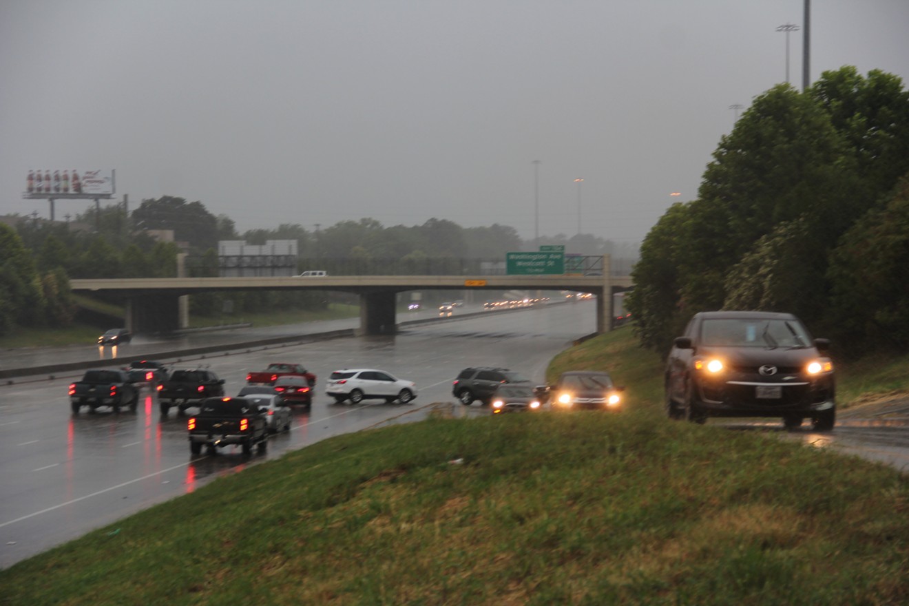
Turn around. Don't drown. Pay heed to that message if you are on the roads Friday night.
Photo by Doogie Roux
KEEP THE HOUSTON PRESS FREE...
Since we started the Houston Press, it has been defined as the free, independent voice of Houston, and we'd like to keep it that way. With local media under siege, it's more important than ever for us to rally support behind funding our local journalism. You can help by participating in our "I Support" program, allowing us to keep offering readers access to our incisive coverage of local news, food and culture with no paywalls.


Use of this website constitutes acceptance of our
terms of use,
our cookies policy, and our
privacy policy
The Houston Press may earn a portion of sales from products & services purchased through links on our site from our
affiliate partners.
©2024
Houston Press, LP. All rights reserved.
