Not to freak anyone out, but we are deep into the month of August and...it hasn't been awful. These are the dog days of summer and they are typically the hottest of the year for us here in Houston. As the guys at Space City Weather pointed out Wednesday, is has been remarkably, uh, normal. And, not to get your hopes up or anything, but there is an ever-so-slight chance of a cool front pushing through the area next week. It's not suddenly going to be 70 around here during the day, but anything helps this time of year.
Anyway, the week was relatively uneventful. A few storms rumbled through central Houston on Wednesday afternoon, but nothing all that shocking for Houston in August. Our weather pattern, for the most part this week, has been dry and warm. Honestly, a rain shower was kinda nice considering.
Going into the weekend, expect more of the same. Highs will be in the mid-90s under partly cloudy to sunny skies. There is about a 15 to 20 percent chance each day of a stray shower, but nothing significant. Should be a pretty nice weekend if you are heading to the beach or hanging out in the pool (or a dark, cold room somewhere).
Watching the Tropics
Subtropical storm Ernesto formed in the northern Atlantic on Wednesday. It might make it to "tropical storm" status before it peters out — if it were to reach tropic storm strength, that would mean it would show more significant organization than now. Otherwise, the Atlantic remains quiet. We are actually a bit ahead in named storms for the year. Ernesto is the fifth named storm. Typically, that doesn't happen until August 31, another good reason to keep an eye on the tropics.
But, if this year has felt quiet, it's mainly because the storms that have been around have had negligible impact on land. Right now, long-range forecasts aren't calling for much of anything over the next two weeks. The continued presence of dry air, Saharan dust and low sea surface temperatures are thwarting development across the Atlantic. Closer to home, though Gulf and Caribbean water temps are plenty warm, high wind shear, another inhibitor of storm growth, is forecast for the next week to 10 days, and the continued likelihood of an emergence of El Niño in September is putting the kibosh on any development.
Anything can happen, but for now, everything looks good.
Support Us
Houston's independent source of
local news and culture
account
- Welcome,
Insider - Login
- My Account
- My Newsletters
- Contribute
- Contact Us
Weather Weekend: More of the Same, But That's Not All Bad
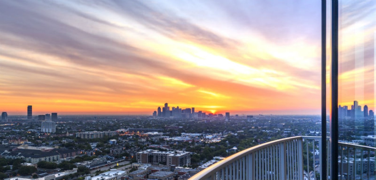
Plenty of lovely sunsets this weekend, with maybe a stray shower in the afternoons.
Photo by Geoffrey Lyon
KEEP THE HOUSTON PRESS FREE...
Since we started the Houston Press, it has been defined as the free, independent voice of Houston, and we'd like to keep it that way. With local media under siege, it's more important than ever for us to rally support behind funding our local journalism. You can help by participating in our "I Support" program, allowing us to keep offering readers access to our incisive coverage of local news, food and culture with no paywalls.


Use of this website constitutes acceptance of our
terms of use,
our cookies policy, and our
privacy policy
The Houston Press may earn a portion of sales from products & services purchased through links on our site from our
affiliate partners.
©2024
Houston Press, LP. All rights reserved.
